I have been watching Ken Burns' The National Parks: America's Best Idea.
It is a must see
Monday, September 28, 2009
A Long Wait
There was the slightest nip of fall in the air as I drove home from Charlotte yesterday. The skies had a western feel to them as the clouds were visible well into the distance, not lost to some endless southern haze. It seems fall has a way of clearing the air even on cloudy days and sparking memories of western travel.
I am ready to go back, but fear a long wait.
I am ready to go back, but fear a long wait.
Wednesday, September 23, 2009
McSparseness

Hints:
Light map of the US.? Nah. But, all the same, distasteful to our modern Luddites in the environmental movement.
Hmm, there appears to be a little darkness on the NC. coast....in a watery sound.
The Goosenecks, and Natural Bridges areas are appropriately dark.
Last hint: California's distaste for corporations that cater to affordability shows up darkly. Cali's a little too dark for Cali. in my opinion.
For answers go to he who deserves thanks. Stephen Von Worley at weathersealed.com.
Friday, September 18, 2009
To the Ears 06/22/2009

Woke up. Got out of bed. Dragged a comb across my head.........Huff. Puff. Huff.........Looking up I noticed I was late.....................

The day started with the same morning routine...only rushed. We had planned an excursion to Bears Ears and needed to get there, hunt for petrified w
 ood and get back to the campground before checkout. We thought it best to leave the camper behind not knowing terrain ahead. A good choice!
I am constantly taken aback by the sudden changes in climate out here. The experience usually occurs when crossing a pass, and once again, we were not prepared for the change experienced after crossing the ridge between Bears Ears. We were greeted by grazing bovine, green fields, ponds, and large pines. The change in
 climate forced us to break out the camera. We had forgotten it up to that point due to hurried nature of the morning. Just moments before we had been surrounded by juniper trees stunted by thirst amid perpetually exposed rocks and soil. Then we we were looking at a pond surrounded by cows. Astounding! What a morning!
At that point we had driven between and beyond Bears Ears. After a few pics we turned around and wound back to Bears Ears to check things out. Below us we were able to see the canyon that housed the natural bridges we saw the afternoon before. It was a nice change in perspective. There were n
 o interesting rocks directly under the "ears", though. We had been told to look under Bears Ears for petrified rocks by a Park Ran
 ger the day before, but that left us wondering.....where? There was a lot of area under Bears Ears. All we could do was poke around. This, initially, led to finding a whole lot of nothing. There were plenty of outcrops, though, along the side of the gravel road we were on. We kept out eyes on those and we stopped many times as we descended back down the mountain. At one stop we found some wildflowers and got a couple of photos of them with one of the Bears Ears as a backdrop.
Perhaps a quarter of the way down the mountain we finally stopped near a wash or dry creek bed. I decided that a wash downstream from Bears Ears
 might be a good place to kick a few rocks. Bingo!! One piece of petrified wood led to another. Some rocks were clearly not petrified wood, but were downright interesting. We added to the total weight we toted around the country that day.
We hurried back to the campground to get our camper before checkout. We were ten or fifteen minutes late but that was OK. We were on our way to Capital Reef before any new campers had shown up.


A short time later we were crossing the Colorado River along an arched metal bridge. I find arched bridges graceful and they only become more so when the arch rises above the traveled p
 ortion of the bridge. The one we were on did this. We didn't know it at the time, but this bridge became an indication of scale later. In fact, this bridge shows up in each and every photo touching this paragraph. After crossing the Colorado we began to ascend out of the gorge cut by the Colorado and were treated with stunning peeks of the are
 a we had been driving through below. We soon came upon a view point and stopped. We were not alone there. There were
  around a dozen others milling around enjoying the view. Most of them were on Harleys and that includes one small dog that rode with a couple. The pup rode in an equally small collapsible pet carrier mounted to the rear fender. Cute.
We continued our drive through some of the most unusual country I have ever seen. There was erosion on a grand scale
 . It was not Grand Canyon style erosion, but rather an erosion that was more familiar. It reminded me of a sand castle overrun by waves or of honey making its way across pancakes. I think this area was eroding at a very quick pace compared with the Grand Canyon.
There were very few gas stations in the area so we stopped at the most interesting one at the first town we hit, Hanksville Utah. It's not that we expect distinction from a convenient store, but when given the choice between a plain old fuel/food stop and one that has been carved out of a big rock, the big rock will win every time. We made use of their facilities which fortunately required a walk past storage areas to the back of the store. This took us past less finished portions of the store that confirmed the fact we were inside a rock. Tourists like myself were taking photos back there; photos of a convenience store. I had left my camera in the van.

We were still driving through hot low land, but were making
 our way to higher land to set up camp. First, though, we drove through Capitol Reef National Park. Small black rocks were everywhere. They had the appearance of chocolate chips in cookies. A quick visit to the visitors center confirmed that
  they were volcanic rock deposited by glaciers. While there we saw a home made teardrop set up for off the grid camping as evidenced by the roof mounted solar panels. Prior to
  the stop at the visitors center a pull off led us to some ancient Fremont Indian petroglyphs chronicling their spacesuit trials. Nice.
As we left Capitol Reef we continued our climb into higher altitudes for another 30 miles. It was getting late and we feared
 we might find only full campgrounds along our route. We stopped at the first one and found it was nearly empty but unappealing so we pushed on to the one that had the pleasing name of Oak Creek Campground in Dixie National Forest. We were hoping for a creek.

We were greeted by cows and only one other camper as we entered Oak Creek. We began to setup camp near the cows but after a short orientation walk decided to move to a site next to the...creek! This was by far the best campsite of he trip so far. The kids immediately made like children and played in the water. It seems dams are still the first o
 rder of business in creek play. Days are long on the western edges of the
  time zones so the kids had a couple of unexpected hours of play before dark. We built a campfire to warm them and later I checked out the site nearest us. It required parking near our site and a walk across a bridge to set up camp. Very nice.
Wednesday, September 16, 2009
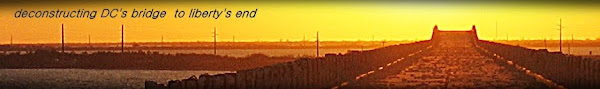
How David Craft, Abuses his Position as Moderator...
His first step is to block you from a thread you are participating in for saying something like "Tin Ear". He will then go on to argue against you and malign you.
And, of course, if you make note of his abusive practices he will label you a whiner.
And for context, here are some David's congenial comments just prior to the blocking. as well as JGW's cowardly sniping from behind his "blocked" wall.
Should David Craft be a moderator?


Subscribe to:
Posts (Atom)
